.png)
Photo by Bev Scott
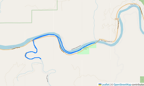
Umpqua River
Umpqua River & Mill Creek
Umpqua Wayside & Scottsburg County Park
The reach of the Umpqua River between Scottsburg and Mill Creek represents the historical head of navigation and a primary gateway to 19th-century Oregon. Founded in 1850, Scottsburg became the busiest port between San Francisco and Portland, serving as the critical transfer point where ocean-going freight was moved to pack trains destined for the interior gold mines. This industrial era saw the river bustling with shallow-draft steamboats until a catastrophic flood in 1861 destroyed the lower town. Nearby, Mill Creek takes its name from the early timber mills that processed the region's dense Douglas fir, and its lower reaches now serve as the drainage for Loon Lake. Today, this stretch of the river is preserved for recreation at the Umpqua Lighthouse State Park and the Umpqua Wayside, which offers a paved launch for paddlers and boaters. This launch site provides access to scenic, tidally influenced flatwaters where modern kayakers can explore the same routes used by the "mosquito fleet" steamboats and the ancestral Lower Umpqua people who inhabited these riverbanks for millennia.
Umpqua River Launch Sites
For expanded details on our launch sites, click the link or hover over the box below and click the image to visit Super Water Trails (SWT). While our "Map and Launch Sites" tab provides basic locations, SWT offers deeper insights into whether the site is open, launch type, tidal, cellular signal availability, fee, if a pass is accepted, and amenities.
Registration is required to access the platform. SWT was developed by FOAK member Annette Chihorek and is free to use, though some premium features are available for a fee.


Photos by Bev Scott
Umpqua River
Paddle Video: Umpqua River
This video is from a FOAK group paddle (9.5 miles) on Umpqua River to Mill Creek on February 14, 2023.