
.png)
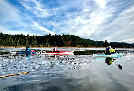
Photo by Bev Scott
Smith River
Smith River, Umpqua River, and Scholfield Creek
Smith River Noel Ranch, Smith River Stowe Marsh (Undeveloped), Umpqua River Rainbow Plaza Boat Launch, Umpqua River Bumblebee Boat Ramp
The confluence of the Umpqua River, Smith River, and Scholfield Creek near Reedsport serves as a major hub for paddling and historical exploration, marking the ancestral home of the Lower Umpqua (Kuitsh) people. The Umpqua River, named by David Douglas in 1825, was a critical artery for the Hudson’s Bay Company fur trade and later became a center for the commercial salmon canning and timber industries that founded Reedsport. The Smith River bears the name of explorer Jedediah Smith, whose 1828 expedition met a violent end at this confluence during a conflict that left 15 of his men dead; today, a memorial stone outside Reedsport commemorates this pivotal event. Branching off the main stem, Scholfield Creek was named for Socrates Scholfield, a member of the 1850 expedition that founded Umpqua City. For modern paddlers, this area offers a diverse range of water trails: the main Umpqua provides broad, navigable reaches, while the Scholfield Creek Wetlands offer a more intimate, wildlife-rich experience through tidally influenced channels and protected old-growth forests.
Smith River, Umpqua River, and Scholfield Creek Launch Sites
For expanded details on our launch sites, click the link below to visit Super Water Trails (SWT). While our "Map and Launch Sites" tab provides basic locations, SWT offers deeper insights into whether the site is open, launch type, tidal, cellular signal availability, fee, if a pass is accepted, and amenities.
Registration is required to access the platform. SWT was developed by FOAK member Annette Chihorek and is free to use, though some premium features are available for a fee.
There are four primary launch sites
for this area:
2. Smith River Stowe Marsh (Undeveloped)
3. Umpqua River Rainbow Plaza Boat Launch


Photos by Bev Scott
Smith River
Paddle Map: Scholfield Creek
Patti Godwin provided this Scholfield Creek paddle map (11.7 miles) and pictures from September 2025.


Paddle Video: Smith River
This video by FOAK member Bev Scott is from a paddle (10.3 miles) on Smith River on November 12, 2023. Note: Bev's recording was interrupted so the recording extended past the launch return to capture the length of the paddle.

